403
Sorry!!
Error! We're sorry, but the page you were looking for doesn't exist.
Qatar- Google to launch 'Street View' of Doha
(MENAFN- Gulf Times) Tech giant Google is scheduled to launch in Qatar the 'Street View' service, the Ministry of Municipality and Urban Planning (MMUP) announced.
Google Maps with 'Street View' facilitates exploration of places around the world through 360-degree panoramic views. Google had earlier photographed the Museum of Islamic Art in Doha with the technology.
Google 'Street View' in charge for Europe and the Middle East, Anthony McLaughlin, was in Doha on August 18 to consult with officials of the Geographic Information Systems (GIS) Centre, which comes under the MMUP.
The visit was to explore the possibility of signing an agreement authorising Google to make 'Street View' images of Qatar and make them available on Internet. The GIS Centre had been authorised, by a joint committee of several government entities, to negotiate with Google and finalise an agreement on the implementation of the project.
Subsequently, a memorandum of understanding on the requirements was signed, on the basis of which, Google will acquire approvals from the authorities concerned prior to commencing the survey works on the streets of Qatar and producing panoramic images.
The MMUP had recently signed a similar memorandum of understanding with the "Hare" company, formerly known as "Navteq," for producing three-dimensional images for the streets of Qatar and its abutting buildings with laser imaging technology.
The agreement gives MMUP the right to obtain the data after completion of its production and enables accessibility to the government agencies associated with the GIS network.
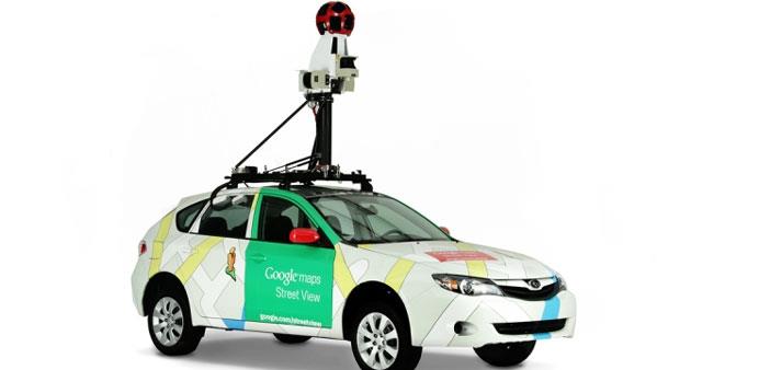
Google procures 'Street View' images by driving around the locations in a vehicle equipped with special cameras and sensors. Many factors will be closely monitored, including the weather and the population density of various areas, to determine when and where the best possible imagery can be collected.
To match each image to its geographical location on the map, Google combines signals from sensors on the car that measure GPS, speed and direction. This helps to reconstruct the car's exact route, and even tilt and realign images as needed.
To avoid gaps in the panoramas, adjacent cameras take slightly overlapping pictures, which are 'stitched' together into a single 360-degree panoramic image

Legal Disclaimer:
MENAFN provides the
information “as is” without warranty of any kind. We do not accept
any responsibility or liability for the accuracy, content, images,
videos, licenses, completeness, legality, or reliability of the information
contained in this article. If you have any complaints or copyright
issues related to this article, kindly contact the provider above.


Comments
No comment